
Education & Workforce
Development
CARNATIONS is dedicated to enhancing educational excellence and workforce development by bridging the gap between education and employment through partnerships with our industry partners and institutions.

Our Goals
Improve Education Quality
Encourage Lifelong Learning
Strengthen Workforce Skills
Support Growth
Featured Courses
We are proud to introduce an innovative inter-university course model that allows students to learn directly from top professors at leading universities. This initiative opens the door to unparalleled expertise and knowledge delivered by faculty from prestigious institutions like, Virginia Tech, Stanford University, UC Riverside, Chicago State University, and Illinois Tech —all accessible from a single platform.

Into to Navigation (Fall-2024, Fall-2025)
Advanced GPS Receiver Design (Spring-2025)
Sensing and Perception for Autonomous Systems Navigation (Spring-2025)
REACH: The Research Engagement and Collaboration Hub
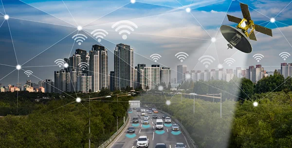
REACH supports students engaged in CARNATIONS research. It provides hands-on training, mentorship, and real-world project experience in resilient positioning, navigation, and timing (R-PNT) systems.
Improve Education Quality
Supports student research in R‑PNT transportation
training
Trains students on CARNATIONS research topics
stipends
Provide stipends for all participating students
Active Projects
CORS RFI / Spoofing Detection and Alerting System
This project focuses on developing a Continuous Operating Reference Station (CORS)-based monitoring system to detect Global Navigation Satellite System (GNSS) disruptions and provide timely alerts to transportation agencies and critical infrastructure operators. By analyzing data from CORS networks, the system identifies abnormal GNSS behavior caused by interference, jamming, spoofing, or other radio frequency disruptions that could impact positioning, navigation, and timing (PNT) services. The research builds upon Virginia Tech's existing CORS monitoring platform by enhancing its data processing capabilities, improving detection algorithms, and expanding its web-based visualization and alerting features. The project leverages cloud computing, statistical analysis, and automated data processing to provide continuous situational awareness of GNSS performance across transportation systems. The outcome will be a web-based demonstration platform capable of monitoring GNSS disruptions in near real time and supporting decision-making for transportation stakeholders and other critical infrastructure operators.
Performance Analysis of CUSUM-Based Anti-Spoofing Algorithms
This project focuses on evaluating a novel anti-spoofing algorithm developed by MITRE for GPS navigation systems. Students will use MATLAB to conduct simulations, analyze performance metrics such as false alarms and missed detections, and assess its effectiveness against traditional methods. Deliverables include simulation results, performance analysis, and a final report, providing hands-on experience in estimation, detection, and resilient navigation systems.
Wrong-Way Driving Detection and R-PNT ADAS-Based Navigation System
This project focuses on developing a resilient R-PNT–enabled ADAS system that transforms vehicles into smart sensors to improve roadway safety. Students will apply concepts in navigation, signal processing, and system design to detect hazardous driving behaviors and generate timely in-vehicle warnings, even in GPS-challenged environments. Deliverables include simulation-based evaluations, scenario analysis, and a final technical report assessing system performance metrics such as detection accuracy and reliability.
High-Fidelity Modeling of GPS Errors for Kalman Filters
This project focuses on both experimental and theoretical aspects of GNSS signal processing and error modeling. Students will apply digital signal processing and GNSS fundamentals using MATLAB, with deliverables including monthly presentations, a final presentation, and a comprehensive report.
UWB Sensor Evaluation for Collaborative Navigation
This project investigates inter-vehicle ranging for collaborative navigation, focusing on evaluating UWB (ultra-wideband) errors and models. Students will review literature, collect UWB data on static and moving platforms, analyze ranging errors, and explore methods to achieve 3D positioning using UWB technology.
Automated Multi-Vehicle Testing Platform Design, Instrumentation, and Testing
This project involves designing and testing an automated multi-vehicle platform, focusing on developing a control system for a ground vehicle. The control system should be adaptable for implementation on other ground vehicles, allowing for scalability and flexibility in multi-vehicle testing environments.
How to Apply for Projects
If you want to be a mentor on one of our projects submit the form below.
If you are interested in any research please submit the form below.